Talk: Geospatial public policy analysis with geopandas @ PyCon US 2020
May 20, 2020Details
- Date: 2020-04-15
- Place: Cleveland, Ohio.
- Event Website: us.pycon.org/2020
- Video: YouTube
- GitHub: github.com/chekos/geospatial-public-policy-analysis-with-geopandas
Description
What if you could take the power of pandas and apply it to geospatial data? That’s what GeoPandas does!
GeoPandas is an open source project to make working with geospatial data in python easier.
- geopandas.org
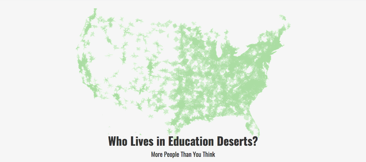
In this tutorial you will analyze openly available data and apply a GIS-lens to it! We’ll use data from the National Center for Education Statistics (NCES) to recreate the map above! We’ll use Integrated Post-secondary Education Data System (IPEDS) data to map out all the higher education institutions in the United States and analyze the results. We’ll look at the equity implications of Education Deserts and learn some really neat pandas and geopandas tricks in the process!
This tutorial is perfect for novice data analysts, pythonistas, social scientists, and journalists that want to learn about the powerful pandas and geopandas libraries and how to use it to analyze openly available data (and for those who’ve been using them but could learn a trick or two to make their workflow even more effective, reproducible and open). Some familiarity with jupyter and pandas is appreciated but not necessary.
Do the words Title IV, PfP/PnP, census blocks, or IPUMS mean anything to you? No?! the more reason to join! Come learn something new!
Contact
Project owners:
- Sergio Sánchez Zavala (https://github.com/chekos)
Licence
GNU General Public License v3.0
# pandas # jupyter # python # talk # tutorial